Cappadocia Golf Course
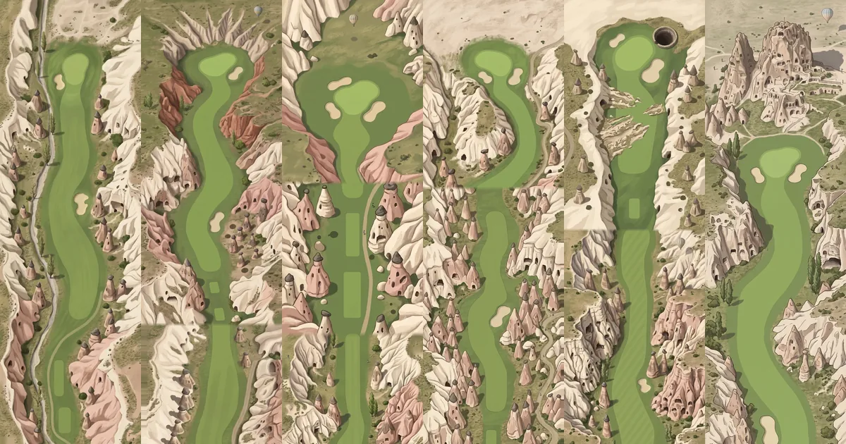
Six of the eighteen holes of the Cappadocia course, seen from above.
A par-72 course drawn in the pale and rose-coloured rock of central Turkey. Fairways run along valley floors between capped stone cones, and every hole is named after a place in the region.
What it draws
Cappadocia lies in central Anatolia, Turkey. Its landscape began as thick volcanic deposits left by ancient eruptions of Mount Erciyes, Mount Hasan and Göllüdağ. The ash hardened into soft rock, and wind and water have been cutting it ever since. Where a column of soft rock keeps a cap of harder stone on top, the cap protects it and a "fairy chimney" is left standing. Göreme National Park and the Rock Sites of Cappadocia have been a World Heritage site since 1985.
People carved this rock as well. There are houses, churches and pigeon-houses cut into the cliffs, and whole underground cities: Derinkuyu goes down about 85 metres and could shelter as many as 20,000 people. The course pictures show all of this from above. Capped cones stand along almost every fairway. Cliff walls are dotted with dark doorways. On hole 4, named after Pigeon Valley (Güvercinlik), one cliff face is covered in rows of small holes; the real valley got its name from the pigeon-houses carved into its sides. A round shaft opens beside the green of hole 17, Derinkuyu. Behind the last green stands a tall rock full of openings, after Uçhisar, whose "castle" is in fact a 60-metre rock formation. Hot-air balloons, a familiar sight in the region, drift over several holes.
The pictures are imagined scenes, not surveys of real valleys. The names are real: Göreme, Çavuşin, Zelve, Paşabağ, Ortahisar, Ihlara, Ürgüp, Avanos and the rest are towns, valleys and rock sites of Cappadocia.
The 18-hole journey
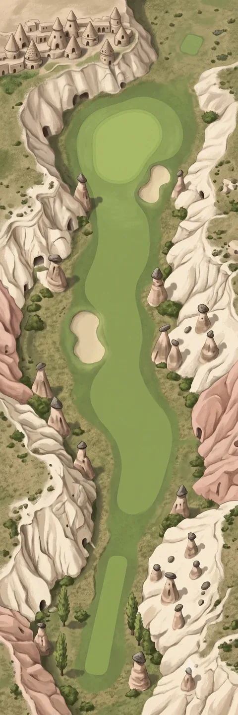 Hole 1 · GöremePar 4 · 350 m (383 yd)
A cluster of cone-shaped rock houses sits on the ledge at the top left. Capped cones stand on both sides of the fairway.
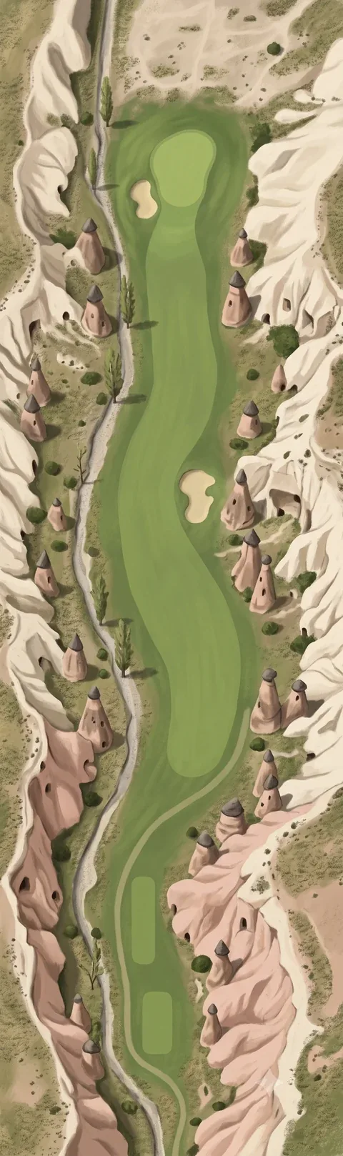 Hole 2 · ÇavuşinPar 4 · 395 m (432 yd)
A narrow track with tall thin trees runs down the left side. Cones with dark caps line the right.
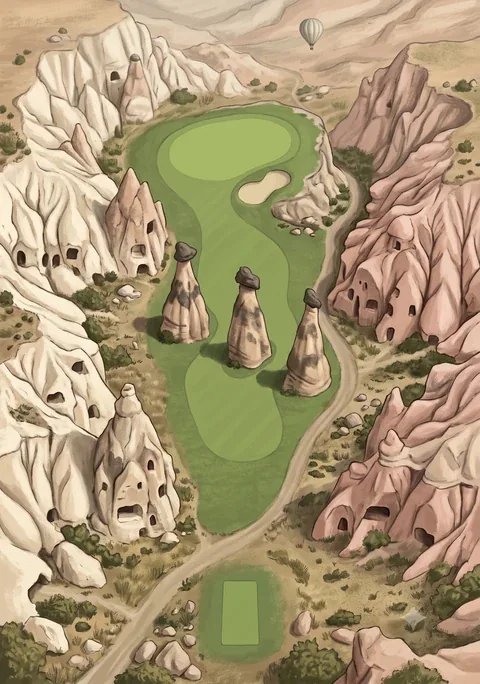 Hole 3 · Üç GüzellerPar 3 · 155 m (170 yd)
Three tall capped chimneys stand in a row in front of the green. A balloon floats in the distance.
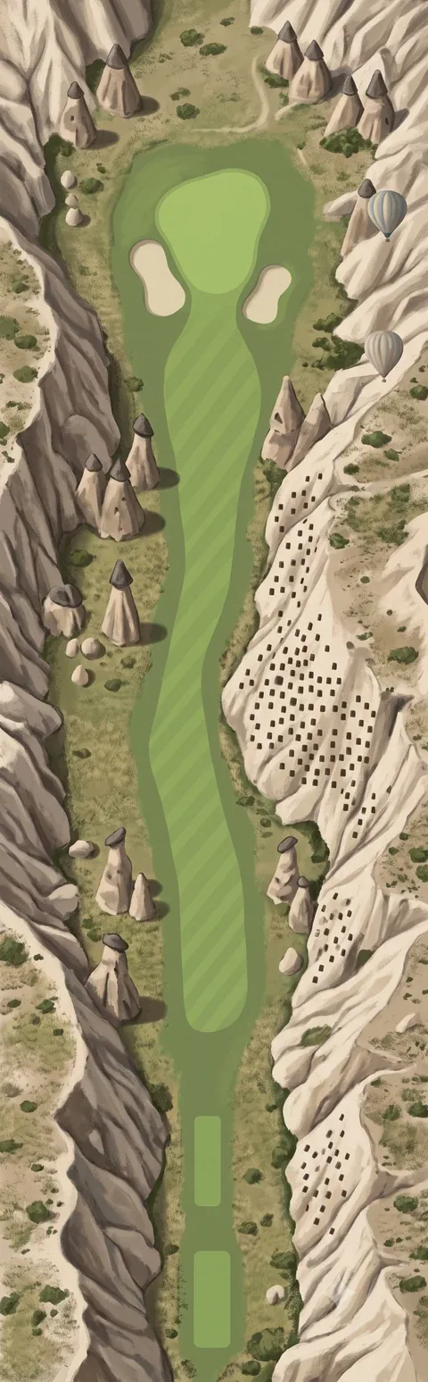 Hole 4 · GüvercinlikPar 4 · 385 m (421 yd)
The right-hand cliff is covered in rows of small holes. Two balloons hang beside the green.
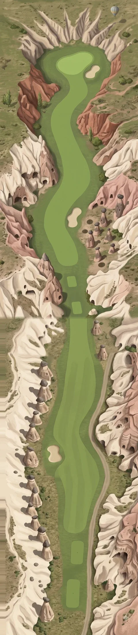 Hole 5 · ZelvePar 5 · 520 m (569 yd)
A long hole through white and red rock, with cave openings in the walls on both sides.
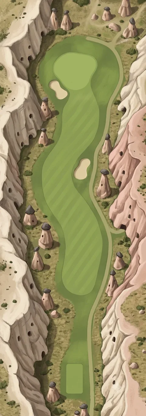 Hole 6 · PaşabağPar 4 · 340 m (372 yd)
Mushroom-capped cones on both sides. A path follows the right edge of the fairway.
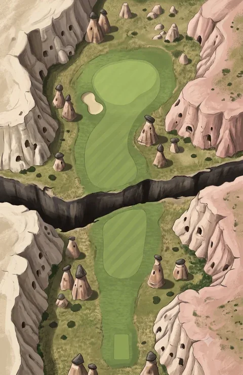 Hole 7 · DevrentPar 3 · 170 m (186 yd)
A dark crack in the ground crosses between tee and green.
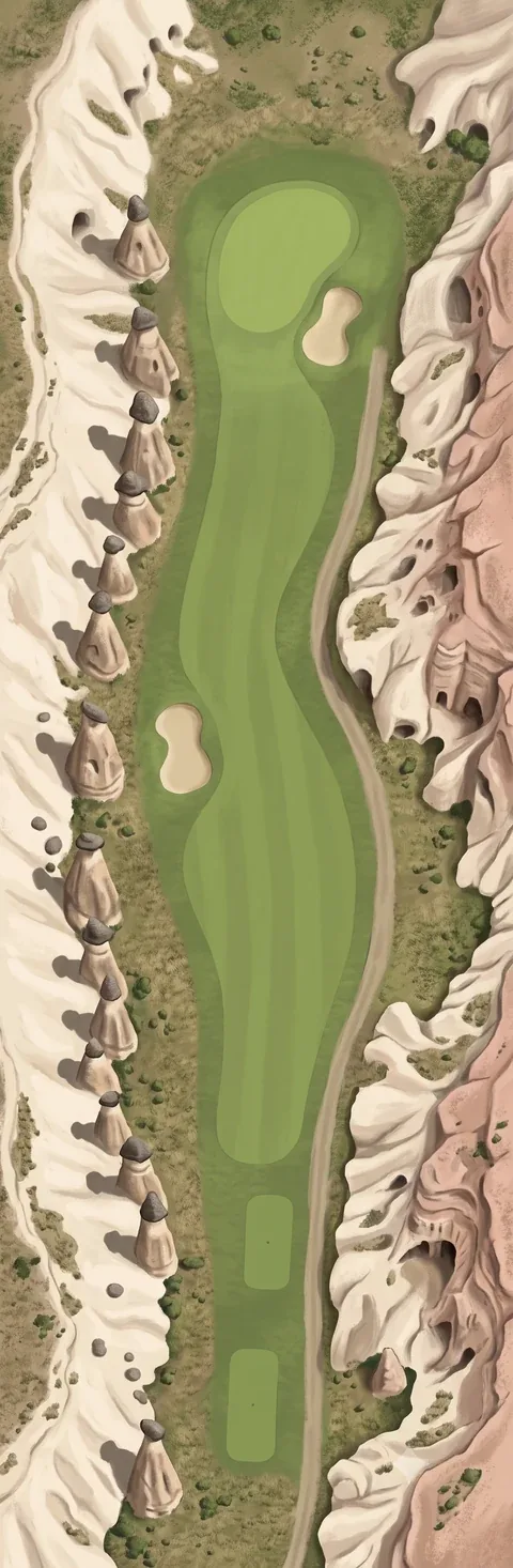 Hole 8 · OrtahisarPar 4 · 360 m (394 yd)
A straight line of capped cones runs down the left side; a path runs down the right.
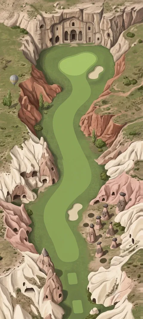 Hole 9 · TokalıPar 4 · 330 m (361 yd)
A carved building front is cut into the cliff behind the green. Red rock closes in on both sides.
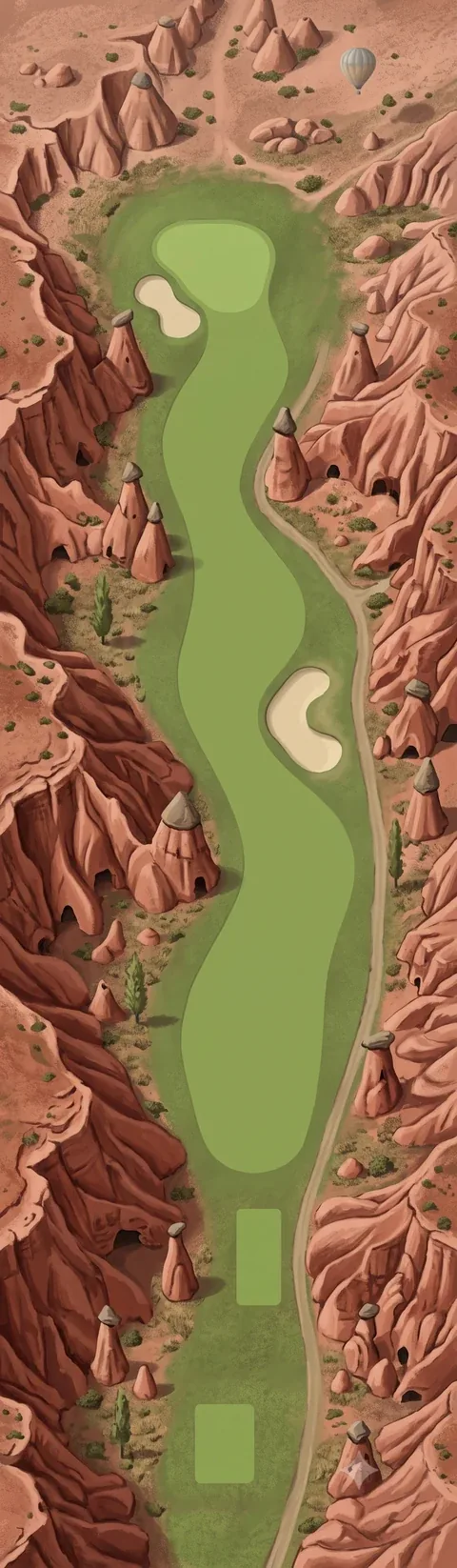 Hole 10 · KızılçukurPar 4 · 405 m (443 yd)
Red rock from top to bottom. The fairway snakes through it, with a balloon over the far end.
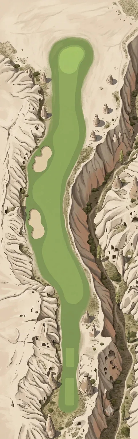 Hole 11 · IhlaraPar 4 · 370 m (405 yd)
A deep gorge runs along the whole right side. Pale, bare ground lies to the left.
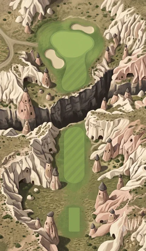 Hole 12 · SoğanlıPar 3 · 185 m (202 yd)
Tee and green face each other across a dark ravine.
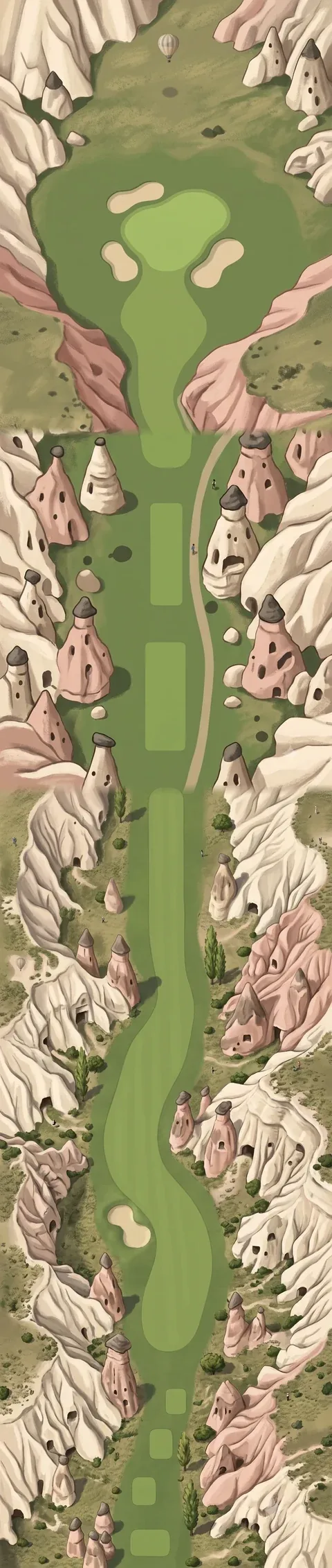 Hole 13 · ÜrgüpPar 5 · 545 m (596 yd)
The longest hole. Cones crowd both sides the whole way, and three bunkers ring the green.
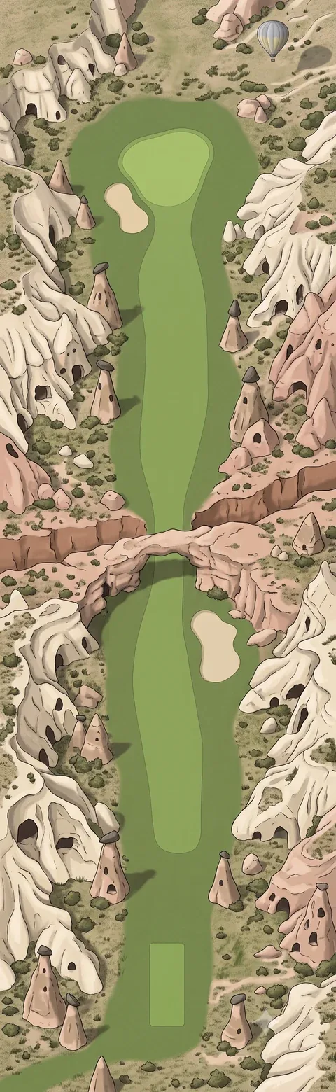 Hole 14 · SelimePar 4 · 415 m (454 yd)
A natural rock bridge and a red cleft cross the fairway at its middle.
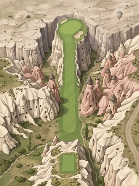 Hole 15 · GüllüderePar 3 · 140 m (153 yd)
A narrow strip between two cliffs leads up to a green on a ledge. Rose-coloured rock on the right.
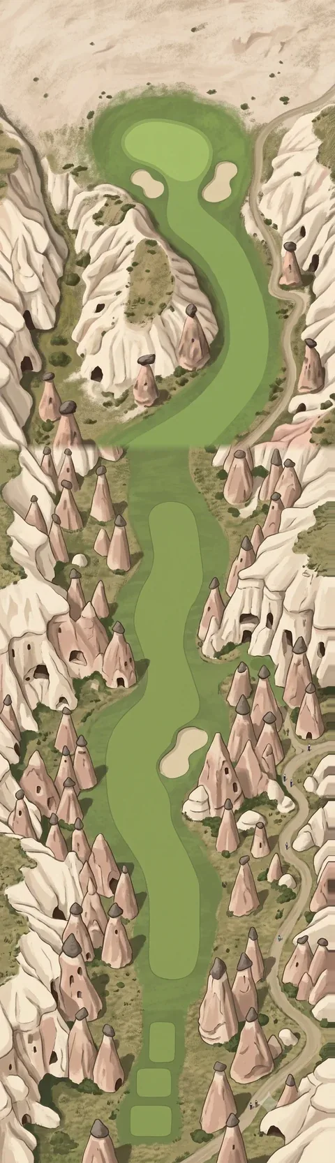 Hole 16 · AvanosPar 4 · 425 m (465 yd)
The fairway bends around a ring of rock with a hollow centre. Cones stand thick on both sides.
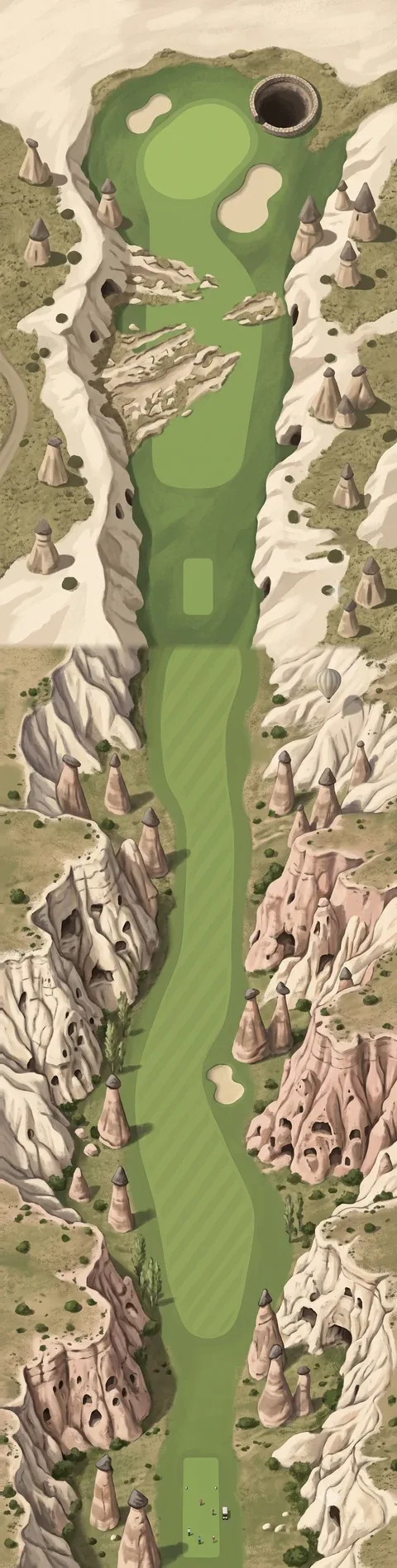 Hole 17 · DerinkuyuPar 5 · 495 m (541 yd)
A round dark shaft opens in the ground beside the green.
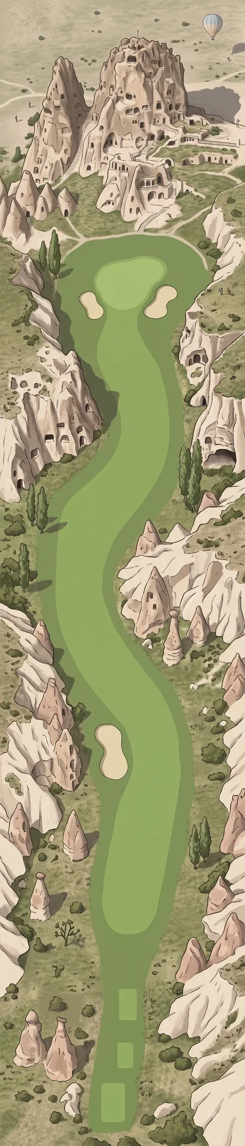 Hole 18 · UçhisarPar 5 · 470 m (514 yd)
A tall rock riddled with openings, with small buildings at its foot, rises behind the green.
Hole notes describe what is drawn in each picture. Par and distances are the game's own course data.
How to play it
Par 72 over 6,455 m (about 7,061 yd), one of the longer courses in the game: four par 3s, ten par 4s and four par 5s. Hole 13 is the longest at 545 m, and three of the four par 5s come in the last six holes (13, 17 and 18).
The par 4s are long as well: holes 10, 14 and 16 are all over 400 m, so expect a long second shot on the back nine. The breathing space is the par 3s, which run from 140 m (hole 15) to 185 m (hole 12).
In the course data two holes carry a water-type hazard: holes 7 and 12, the two par 3s drawn across a ravine. There are 24 bunkers in the data, and holes 3, 7, 9, 10, 12 and 15 have none.
More about this place
For the place itself - its nature, history and seasons - see the travel guide on Shake & Talk: Cappadocia: Rock Valleys, Cave Churches, Underground Cities
Sources: Cappadocia · G%C3%B6reme National Park · Fairy chimney · Derinkuyu underground city · U%C3%A7hisar