Desert
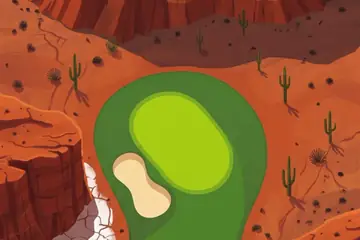
Mesas, slot canyons and stone arches: the red rock of the Colorado Plateau.
Where it is
Moab is a small town in south-eastern Utah, on the Colorado River, in the middle of the Colorado Plateau. The land around it is layered sandstone, lifted high and then cut by rivers into mesas, canyons, fins and towers, and coloured red by iron in the rock.
Two national parks sit on either side of the town. Arches National Park holds more than two thousand natural stone arches, the densest collection known. Canyonlands National Park is the country where the Green River meets the Colorado; its high northern district, Island in the Sky, is a mesa with a sheer drop on three sides.
The painted course is a wider collage of the American Southwest. Some things in its pictures, such as the tall saguaro cactus, belong further south in Arizona and do not grow around Moab.
The picture course
The painted course is almost entirely red and orange. Canyon rims and flat-topped mesas close the top of each picture, and the fairways run along the foot of cliffs, beside deep slots filled with shadow, and across cracked desert floor. A pale dry wash crosses the third hole, rows of cactus line another, white salt flats with stone spires appear on the back nine, and on one hole a natural arch spans the fairway itself. A single turquoise spring late in the round is the only water.
Par 72 over 6,470 m: 4 par threes, 10 par fours and 4 par fives. The front nine is par 36 (3,165 m) and the back nine par 36 (3,305 m). The longest hole is number 13, a par 5 of 540 m; the shortest is number 3, a par 3 of 165 m.
| Hole | 1 | 2 | 3 | 4 | 5 | 6 | 7 | 8 | 9 |
|---|---|---|---|---|---|---|---|---|---|
| Par | 4 | 4 | 3 | 4 | 5 | 4 | 3 | 4 | 5 |
| m | 365 | 350 | 165 | 350 | 515 | 375 | 185 | 330 | 530 |
| Hole | 10 | 11 | 12 | 13 | 14 | 15 | 16 | 17 | 18 |
| Par | 4 | 4 | 3 | 5 | 4 | 3 | 4 | 4 | 5 |
| m | 380 | 370 | 185 | 540 | 385 | 185 | 380 | 340 | 540 |
The map course: 9 pins
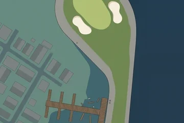
The map course is played on the real map, from one real place to the next: 9 pins, par 38, 324 km from the first tee to the last pin. Distances are real kilometres; the pictures of the holes are satellite views.
Route of the map course: the tee (T) and the pins in playing order.
- Tee · Mesa ArchRock
The tee is at Mesa Arch, the arch on the cliff edge of Island in the Sky in Canyonlands.
- 1 · Arches National ParkSight · 47.1 km · Par 5
The national park north of Moab with the greatest gathering of natural stone arches in the world.
- 2 · Canyonlands Regional AirportAirport · 18.9 km · Par 3
The small airport north of Moab, in open desert.
- 3 · Green RiverStation · 44.3 km · Par 5
The railway station of Green River, the town on the river of the same name.
- 4 · Roan PeaksMountain · 40.0 km · Par 4
A mountain in the cliffs north of the desert floor.
- 5 · SagersTown · 29.7 km · Par 4
A hamlet in Grand County beside the old railway line.
- 6 · Double ArchRock · 30.8 km · Par 4
Two great arches that spring from the same stone foot, in the Windows area of Arches National Park.
- 7 · Grand View Point OverlookViewpoint · 49.1 km · Par 5
The viewpoint at the southern tip of Island in the Sky, looking over the canyons of the two rivers.
- 8 · Canyonlands National ParkSight · 18.9 km · Par 3
The national park of the Green and Colorado river canyons.
- 9 · Monticello AirportAirport · 45.0 km · Par 5
The airport of Monticello, the town at the foot of the Abajo Mountains to the south.
Par and distances are the game's own course data. The pins are real places listed in Wikidata; what is said about them is kept to well-known facts.
Travel notes
Spring and autumn are the mild seasons on the plateau; summers are very hot and winters cold, sometimes with snow on the red rock. The things worth seeing are made of stone and do not change: the arches, the view from the rim of Island in the Sky, and the bend of the Colorado River below the cliffs.
More courses
Sources: Moab, Utah · Colorado Plateau · Arches National Park · Canyonlands National Park · Mesa Arch · Saguaro · Canyonlands Regional Airport · Green River station (Utah) · Double Arch (Utah) · Monticello Airport (Utah) · Wikidata (CC0)