Philippine Islands Golf Course
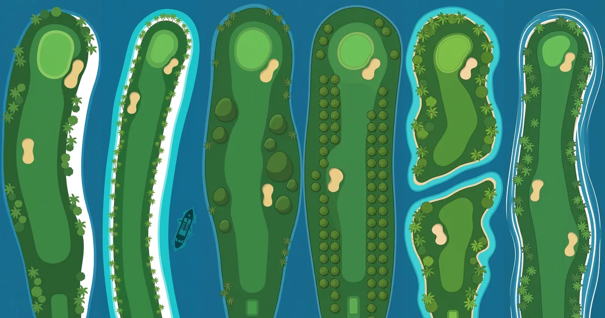
Six of the eighteen holes of the Philippine Islands course, seen from above.
A par-71 course drawn as eighteen small islands in a blue sea. Every fairway is an island, and every hole carries the name of a real one.
What it draws
The course is named for the Philippines, an archipelago of about 7,641 islands in the western Pacific, usually grouped into Luzon, the Visayas and Mindanao. Each of the eighteen holes borrows the name of one island or island group, starting at Boracay and finishing at Tubbataha, the reef in the Sulu Sea.
The hole pictures are flat, top-down illustrations, not maps. They do not trace the real coastline of any island. What each one takes from its namesake is a single feature that people know the place by. Boracay gets a strip of white sand down one side of the fairway. El Nido, whose name means "the nest" after the swiftlets that nest in its limestone cliffs, gets two dark rocks standing in the water. Bohol gets rounded mounds beside the fairway, after the Chocolate Hills: at least 1,260 grass-covered limestone hills that turn brown in the dry season. Camiguin, known as "the Island Born of Fire", gets a brown cone with a crater. Siargao, the surfing capital of the country, gets white lines of surf along both shores.
The last hole is drawn as a chain of islets, a nod to Tubbataha, which is made up of two atolls and a smaller reef and has been a World Heritage site since 1993. Everything else on the pictures - palms, sand bunkers, the colour of the shallows - is the illustrator's own island scenery.
The 18-hole journey
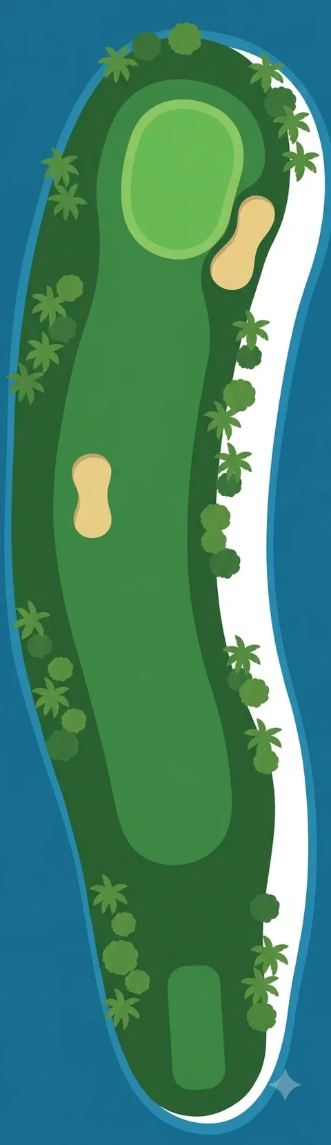 Hole 1 · BoracayPar 4 · 330 m (361 yd)
One long island. A band of white sand runs down the right-hand shore; palms and round trees line both sides. One bunker beside the fairway, one at the green.
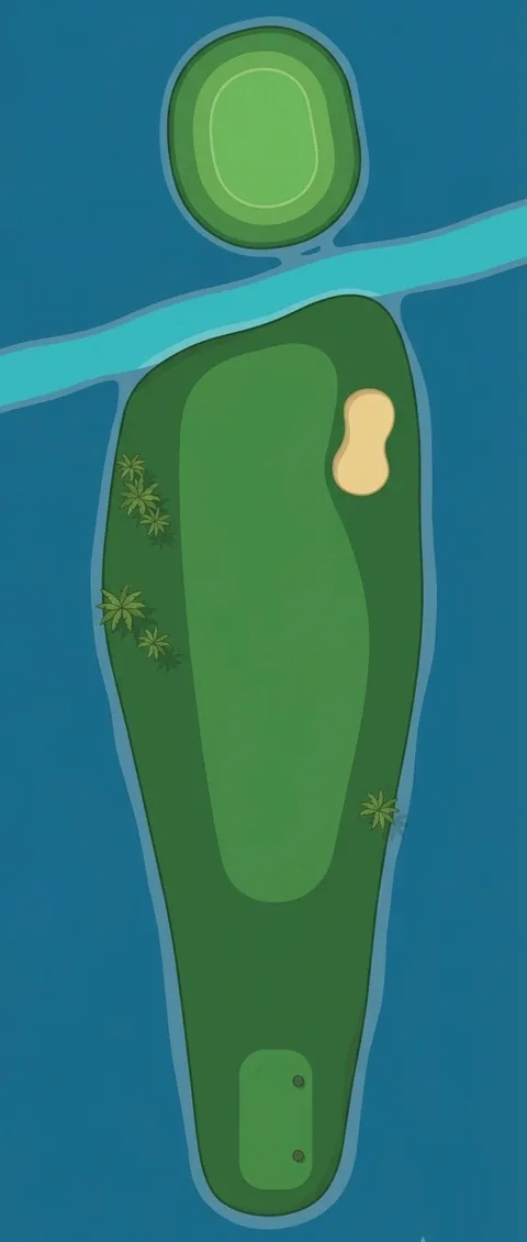 Hole 2 · BantayanPar 4 · 300 m (328 yd)
A light-blue channel cuts across in front of the green, which sits on its own round islet. One bunker on the right of the fairway.
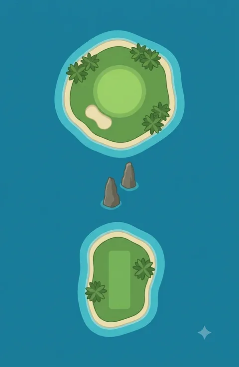 Hole 3 · El NidoPar 3 · 165 m (180 yd)
Tee on one islet, green on another. Two dark rocks stand in the water between them.
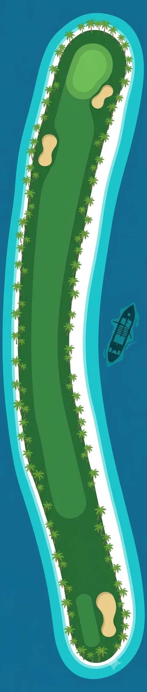 Hole 4 · CoronPar 5 · 480 m (525 yd)
A long island that bends twice, ringed with pale sand and turquoise shallows. A boat lies in the water on the right.
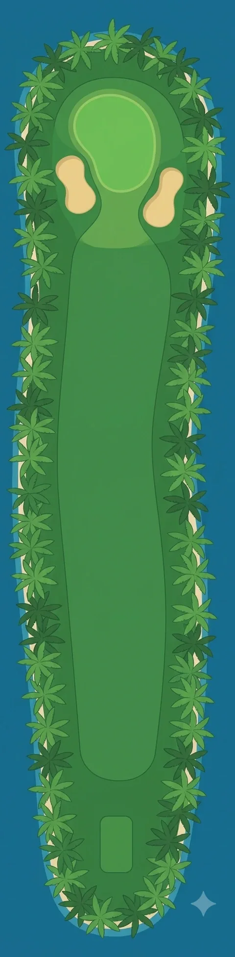 Hole 5 · MalapascuaPar 4 · 345 m (377 yd)
A straight fairway walled in by palms on both sides. Two bunkers stand either side of the green.
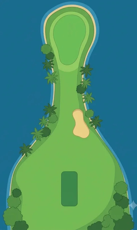 Hole 6 · PanglaoPar 3 · 155 m (170 yd)
A wide teeing ground that narrows to a neck, with the green out at the tip. One bunker in the neck.
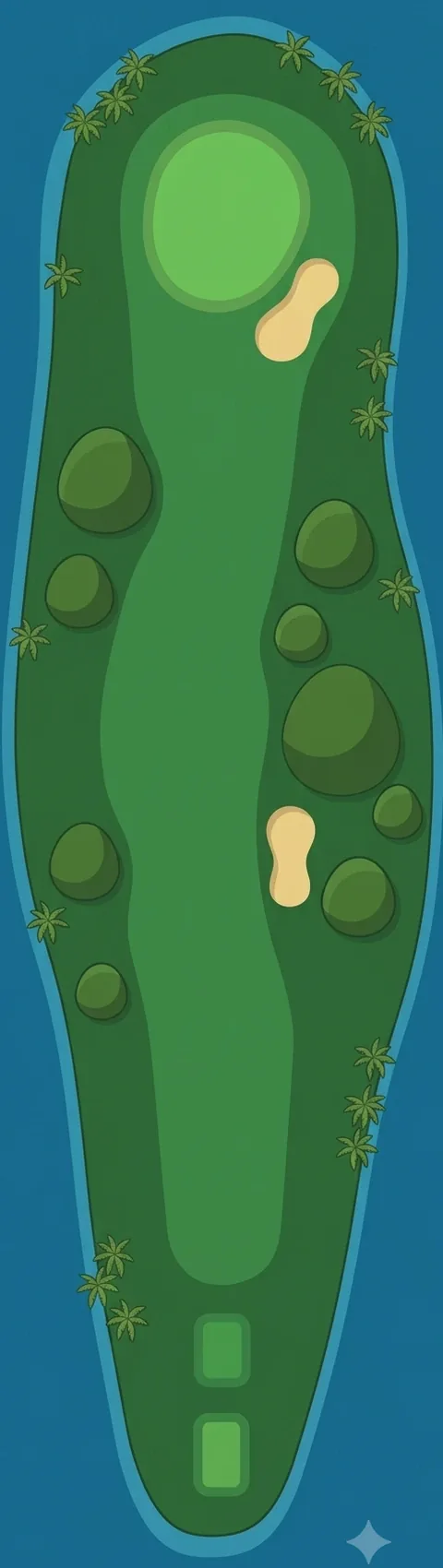 Hole 7 · BoholPar 4 · 360 m (394 yd)
Rounded dark-green mounds sit on both sides of the fairway. Two bunkers on the way, one at the green.
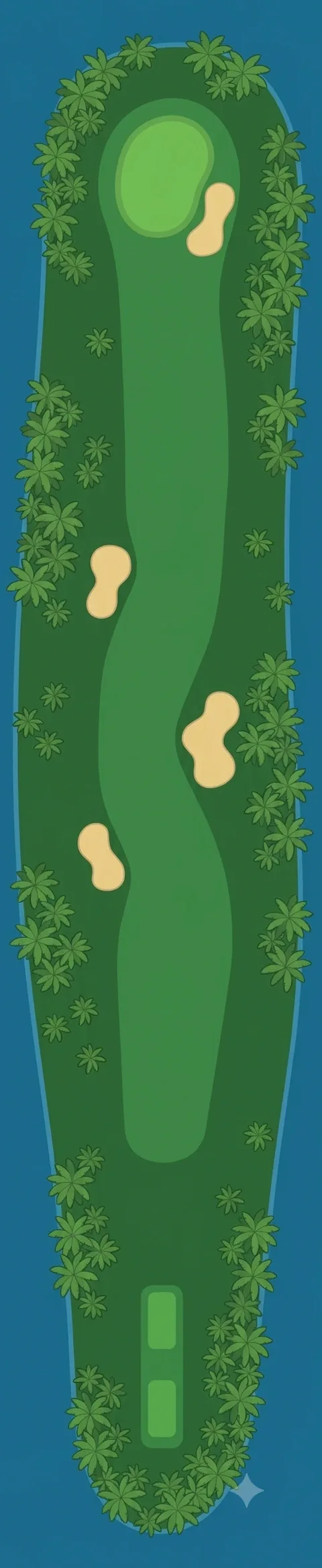 Hole 8 · CebuPar 5 · 495 m (541 yd)
The longest island so far, lined with palms. Bunkers alternate left and right, with one more at the green.
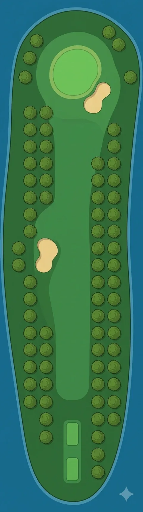 Hole 9 · GuimarasPar 4 · 320 m (350 yd)
Round trees planted in straight rows on both sides, like an orchard. One bunker left, one at the green.
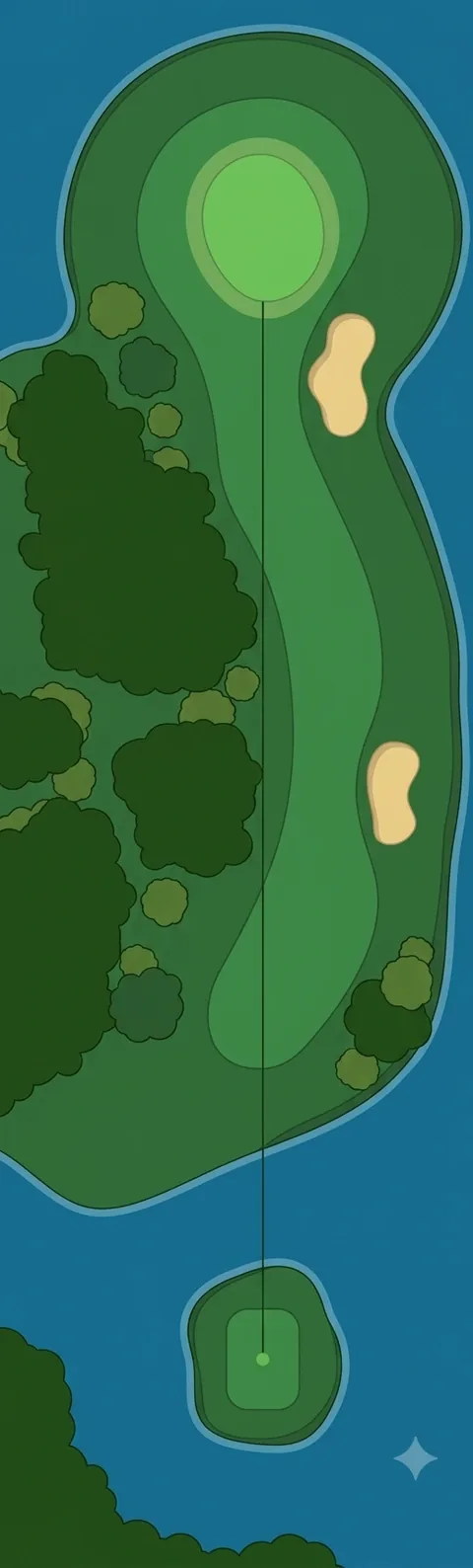 Hole 10 · SiquijorPar 4 · 335 m (366 yd)
The tee is a small islet; the shot starts over water. Thick dark forest fills the left side of the main island.
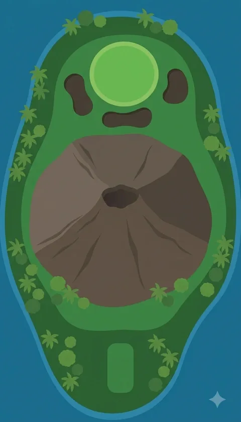 Hole 11 · CamiguinPar 3 · 175 m (191 yd)
A brown cone with a crater lies between tee and green. Three dark bunkers sit around the green.
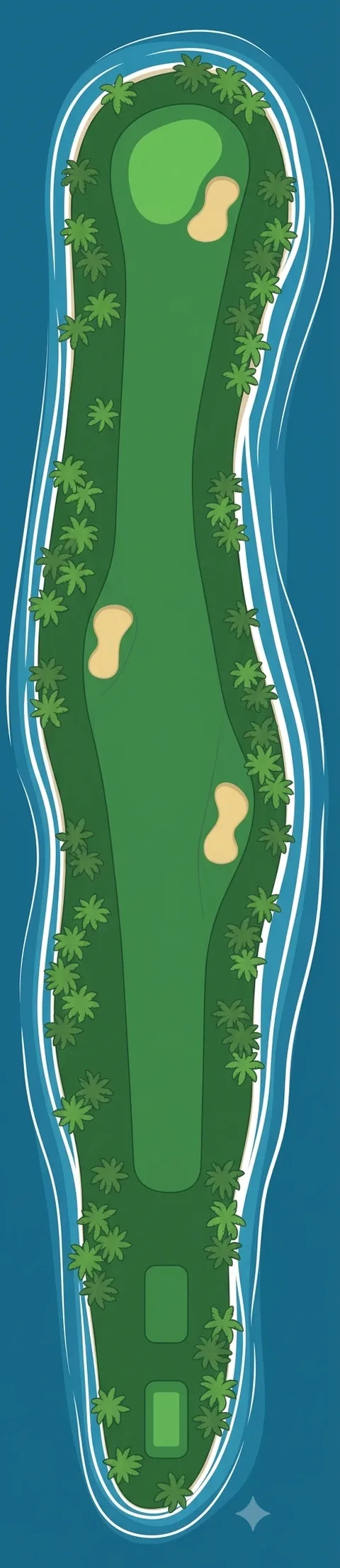 Hole 12 · SiargaoPar 5 · 505 m (552 yd)
A long, narrow island. White lines of surf run along both shores from tee to green.
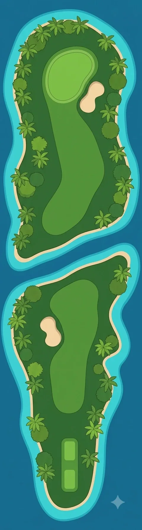 Hole 13 · DinagatPar 4 · 350 m (383 yd)
Two islands with a channel between them. The fairway starts on one and finishes on the other.
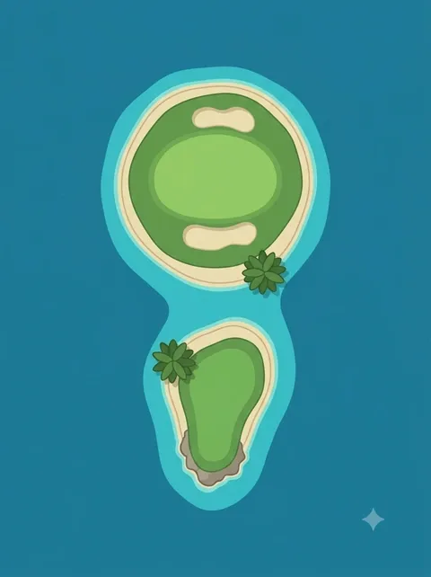 Hole 14 · BalabacPar 3 · 145 m (159 yd)
The smallest picture: a round green islet with a bunker in front and one behind, and a tiny tee islet just below it.
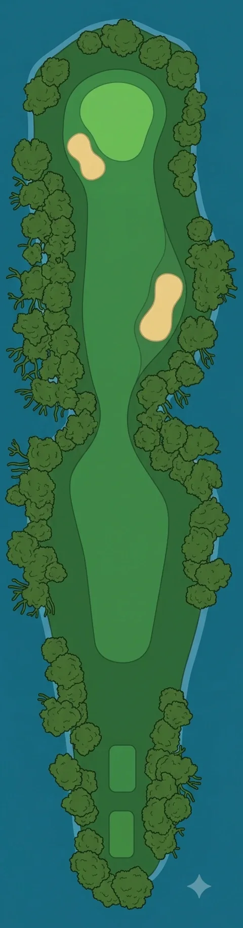 Hole 15 · BasilanPar 4 · 370 m (405 yd)
Trees with tangled roots crowd in from both sides and pinch the fairway in the middle.
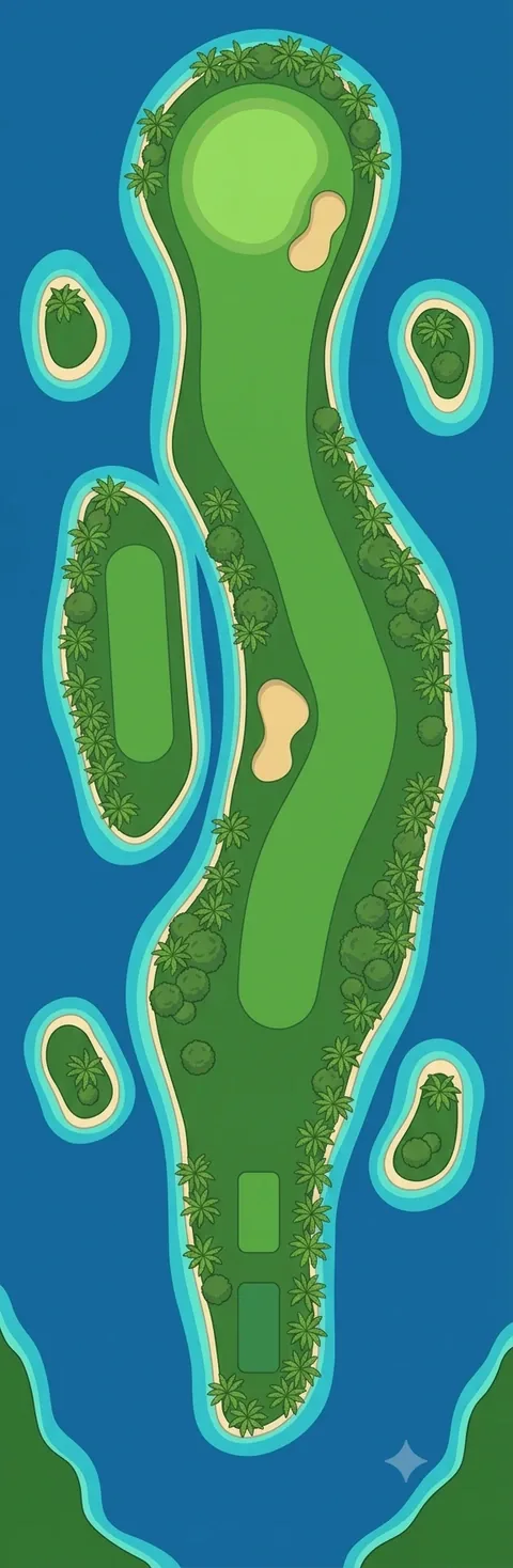 Hole 16 · SuluPar 4 · 340 m (372 yd)
One main island with four small islets around it. The fairway winds past a bunker in the middle.
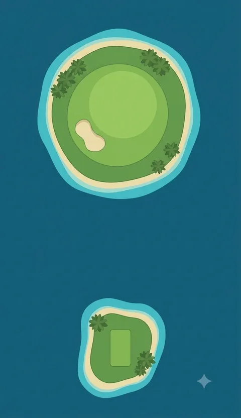 Hole 17 · Tawi-TawiPar 3 · 185 m (202 yd)
A small tee islet at the bottom, open water, then a round island that is almost all green.
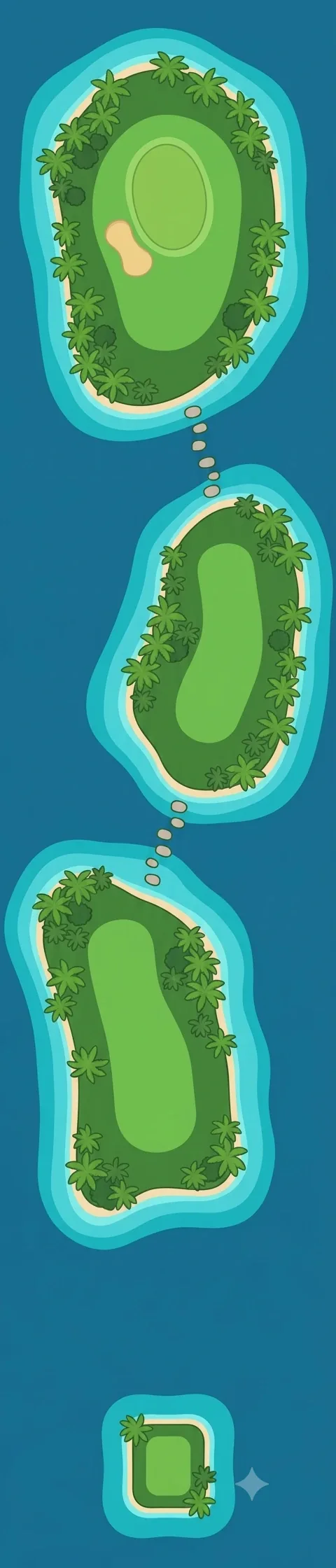 Hole 18 · TubbatahaPar 5 · 505 m (552 yd)
A square tee islet, then three islands in a row joined by dotted stepping stones. The green is on the last one.
Hole notes describe what is drawn in each picture. Par and distances are the game's own course data.
How to play it
Par 71 over 5,860 m (about 6,408 yd): five par 3s, nine par 4s and four par 5s. The four par 5s (holes 4, 8, 12 and 18) all run 480 m or more; holes 12 and 18 are the longest at 505 m.
The short holes are where the water is. In the course data six holes carry a water hazard (2, 3, 13, 14, 17 and 18), and three of the five par 3s are among them. Hole 14 is the shortest at 145 m and has the smallest target; hole 17 is the longest par 3 at 185 m and is all carry.
Every hole has at least one bunker (36 in the data), and the sea is never far from either edge of a fairway, so a straight tee shot is worth more here than a long one.
More about this place
For the place itself - its nature, history and seasons - see the travel guide on Shake & Talk: The Philippine Islands: A First Look at 7,641 Islands
Sources: Philippines · Chocolate Hills · El Nido, Palawan · Camiguin · Siargao · Tubbataha Reefs Natural Park