Serengeti
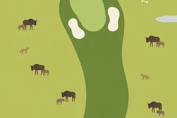
Grassland to the horizon, granite outcrops, and more than a million wildebeest on the move.
Where it is
The Serengeti is a vast grassland in northern Tanzania that continues across the Kenyan border as the Maasai Mara. Its name is usually traced to a Maasai word for "endless plains". Serengeti National Park, the heart of the region, has been a UNESCO World Heritage Site since 1981.
The plains are the stage of the great migration: well over a million wildebeest, with zebras and gazelles, circle the ecosystem each year following the rain and the new grass. Calves are born on the short-grass plains of the south; later the herds push west and north and have to cross rivers where crocodiles wait.
Scattered over the grass are kopjes, rounded piles of ancient granite that stand up like islands. They hold water and shade, and lions and leopards use them as lookouts.
The picture course
The painted course tells the migration in eighteen pictures, in flat shapes and warm ochre. It opens on green rainy-season grass dotted with wildebeest, then dries to gold: a lone acacia, a soda pan, vehicle tracks, red termite mounds, a line of elephants. Mid-round a vulture circle and a column of marching animals take over the picture, and the back nine brings the river crossing, a great grey kopje with lions on it, and the first rain clouds.
Par 72 over 5,605 m: 4 par threes, 10 par fours and 4 par fives. The front nine is par 36 (2,797 m) and the back nine par 36 (2,808 m). The longest hole is number 13, a par 5 of 490 m; the shortest is number 4, a par 3 of 144 m.
| Hole | 1 | 2 | 3 | 4 | 5 | 6 | 7 | 8 | 9 |
|---|---|---|---|---|---|---|---|---|---|
| Par | 4 | 4 | 5 | 3 | 4 | 4 | 5 | 4 | 3 |
| m | 280 | 281 | 478 | 144 | 321 | 322 | 480 | 331 | 160 |
| Hole | 10 | 11 | 12 | 13 | 14 | 15 | 16 | 17 | 18 |
| Par | 4 | 4 | 3 | 5 | 4 | 4 | 3 | 4 | 5 |
| m | 282 | 285 | 154 | 490 | 305 | 325 | 151 | 348 | 468 |
The map course: 9 pins
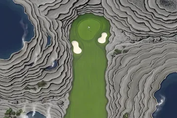
The map course is played on the real map, from one real place to the next: 9 pins, par 38, 332 km from the first tee to the last pin. Distances are real kilometres; the pictures of the holes are satellite views.
Route of the map course: the tee (T) and the pins in playing order.
- Tee · Serengeti International AirportAirport
The tee is at the site of a proposed airport near Mugumu, outside the park's north-western edge.
- 1 · Grumeti Game ReserveSight · 52.2 km · Par 5
A game reserve on the north-western border of the national park, set up in the 1990s as a buffer for the migration route.
- 2 · Grumeti RiverAirport · 15.5 km · Par 3
An airstrip that carries the name of the Grumeti, the river of the park's western corridor.
- 3 · Serengeti National ParkSight · 49.8 km · Par 5
The national park itself; the pin stands in its western plains.
- 4 · SeroneraTown · 24.9 km · Par 4
The settlement at the centre of the park, where its headquarters and visitor facilities are.
- 5 · Moru KopjesMountain · 34.7 km · Par 4
A cluster of granite kopjes south of Seronera.
- 6 · Kerimasi volcanoMountain · 34.3 km · Par 4
An old volcano far to the east, beside Ol Doinyo Lengai on the edge of the rift.
- 7 · Fort IkomaTown · 54.2 km · Par 5
A village near the park's western edge, named after a fort from the German colonial period.
- 8 · Bigo HillsMountain · 31.3 km · Par 4
Hills in the plains; a mid-length hole with nothing but grass on the way.
- 9 · Maji Moto HillsMountain · 35.2 km · Par 4
Hills whose Swahili name, maji moto, means "hot water".
Par and distances are the game's own course data. The pins are real places listed in Wikidata; what is said about them is kept to well-known facts.
Travel notes
There is something to see in every season, because the herds are always somewhere. Roughly, calving happens on the southern plains early in the year, and the river crossings come in the dry months in the middle of the year; the exact timing follows the rain. The kopjes and the open horizon are there all year.
More courses



Sources: Serengeti · Serengeti National Park · Kopje · Grumeti River · Grumeti Game Reserve · Seronera · Serengeti International Airport · Kerimasi · Wikidata (CC0)